Property Record
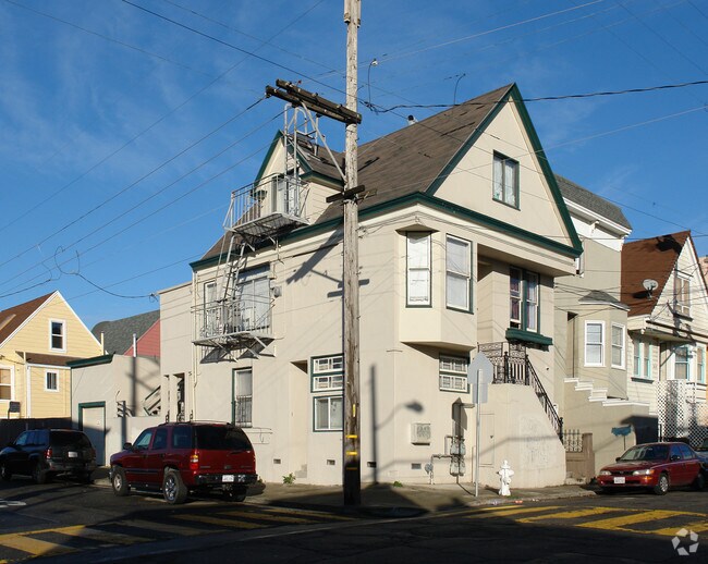
3840 Folsom St, San Francisco, CA 94110


NEARBY LISTINGS FOR SALE OR LEASE
Property Detail
3840 Folsom St
San Francisco
Gift Map #2
San Francisco-San Mateo-Redwood City, CA
MAP 2A PG 13 LOT 452
5683-005
San Francisco
Apartment
California
2024
5
2025
0.04 AC
025402
Bernal Heights
2,427 SF
DEMOGRAPHICS near 3840 Folsom St
1 mile
3 mile
5 mile
2024 Total Population
58,206
397,888
822,780
2029 Population
53,430
366,820
761,939
Pop Growth 2024-2029
(8.21%)
(7.81%)
(7.39%)
Average Age
42
42
42
2024 Total Households
20,611
154,514
343,334
HH Growth 2024-2029
(8.55%)
(8.07%)
(7.74%)
Median Household Inc
$139,886
$134,490
$124,518
Avg Household Size
2.70
2.40
2.30
2024 Avg HH Vehicles
1.00
1.00
1.00
Median Home Value
$1,094,369
$1,085,513
$1,091,898
Median Year Built
1947
1951
1949
Nearby Places
Map Layers
Map Styles
 Street
 Aerial
Transit
 Traffic
 Biking
Places
Listings with unknown addresses are not visible on the map
- Restaurants
- Banks
- Shops
- Fitness
- Groceries
PUBLIC TRANSPORTATION
TRANSIT/SUBWAY
San Jose Ave & Randall St (J Church - San Francisco Municipal Railway (MUNI Metro))
Drive
Walk
Distance
San Jose Ave & Randall St (J Church - San Francisco Municipal Railway (MUNI Metro))
2 min
14 min
0.7 mi
30th Street and Dolores (J Church - San Francisco Municipal Railway (MUNI Metro))
Drive
Walk
Distance
30th Street and Dolores (J Church - San Francisco Municipal Railway (MUNI Metro))
3 min
15 min
0.8 mi
Church and 29th Street (J Church - San Francisco Municipal Railway (MUNI Metro))
Drive
Walk
Distance
Church and 29th Street (J Church - San Francisco Municipal Railway (MUNI Metro))
4 min
19 min
1.0 mi
COMMUTER RAIL
Drive
Walk
Distance
6 min
2.7 mi
Drive
Walk
Distance
8 min
3.2 mi
AIRPORT
San Francisco International
Drive
Walk
Distance
San Francisco International
17 min
10.6 mi
Metro Oakland International
Drive
Walk
Distance
Metro Oakland International
35 min
22.2 mi
Norman Y Mineta San Jose International
Drive
Walk
Distance
Norman Y Mineta San Jose International
53 min
42.2 mi
Nearby Properties
Address
Land Use
TOTAL SIZE
Lot Size
Zoning
Address
Land Use
TOTAL SIZE
Lot Size
Zoning
750,370 SF
3.25 AC
MBR3
Address
Land Use
TOTAL SIZE
Lot Size
Zoning
248,303 SF
4.35 AC
Address
Land Use
TOTAL SIZE
Lot Size
Zoning
717,234 SF
3.47 AC
UMU
Address
Land Use
TOTAL SIZE
Lot Size
Zoning
10.92 AC
Address
Land Use
TOTAL SIZE
Lot Size
Zoning
885,581 SF
5.20 AC
M2
Address
Land Use
TOTAL SIZE
Lot Size
Zoning
1.52 AC
C3G
Address
Land Use
TOTAL SIZE
Lot Size
Zoning
2.74 AC
Address
Land Use
TOTAL SIZE
Lot Size
Zoning
313,306 SF
1.23 AC
WMUG
Address
Land Use
TOTAL SIZE
Lot Size
Zoning
314,826 SF
1.85 AC
MB-RA
Address
Land Use
TOTAL SIZE
Lot Size
Zoning
10.92 AC
Address
Land Use
TOTAL SIZE
Lot Size
Zoning
393,918 SF
3.36 AC
WMUG
Address
Land Use
TOTAL SIZE
Lot Size
Zoning
24.37 AC
Address
Land Use
TOTAL SIZE
Lot Size
Zoning
241,659 SF
3.76 AC
Address
Land Use
TOTAL SIZE
Lot Size
Zoning
230,853 SF
3.76 AC
Address
Land Use
TOTAL SIZE
Lot Size
Zoning
302,084 SF
0.88 AC
MBO
Address
Land Use
TOTAL SIZE
Lot Size
Zoning
674,317 SF
3.36 AC
UMU
Address
Land Use
TOTAL SIZE
Lot Size
Zoning
319,119 SF
0.76 AC
Address
Land Use
TOTAL SIZE
Lot Size
Zoning
222,000 SF
1 AC
MB-RA
Address
Land Use
TOTAL SIZE
Lot Size
Zoning
10.92 AC
Address
Land Use
TOTAL SIZE
Lot Size
Zoning
2.93 AC
Address
Land Use
TOTAL SIZE
Lot Size
Zoning
342,727 SF
1.36 AC
C3G
Address
Land Use
TOTAL SIZE
Lot Size
Zoning
291,522 SF
6.66 AC
CM
Address
Land Use
TOTAL SIZE
Lot Size
Zoning
250,884 SF
1.66 AC
MB-RA
Address
Land Use
TOTAL SIZE
Lot Size
Zoning
375,030 SF
0.96 AC
Address
Land Use
TOTAL SIZE
Lot Size
Zoning
248,974 SF
0.88 AC
MBO
Address
Land Use
TOTAL SIZE
Lot Size
Zoning
345,000 SF
1.74 AC
WMUG
Address
Land Use
TOTAL SIZE
Lot Size
Zoning
0.75 AC
SLI
Address
Land Use
TOTAL SIZE
Lot Size
Zoning
2.22 AC
M1
Address
Land Use
TOTAL SIZE
Lot Size
Zoning
332,221 SF
1.17 AC
Address
Land Use
TOTAL SIZE
Lot Size
Zoning
2.06 AC
The World's #1 Commercial Real Estate Marketplace
Connect with us
© 2026 CoStar Group
The information above has been obtained from sources believed reliable. While we do not doubt its accuracy we have not verified it and make no guarantee, warranty or representation about it. It is your responsibility to independently confirm its accuracy and completeness. Any projections, opinions, assumptions, or estimates used are for example only and do not represent the current or future performance of the property. The value of this transaction to you depends on tax and other factors which should be evaluated by your tax, financial, and legal advisors. You and your advisors should conduct a careful, independent investigation of the property to determine to your satisfaction the suitability of the property for your needs.